Summer 2019 Monterey Trip

Last year when I sailed to Monterey there was no wind so the trip was nearly all motoring. This weekend was a much nicer round trip to Monterey, 100% sailing this time!

Day 1

Saturday morning was typical Santa Cruz summer gloom, heavy fog and no wind. Did not look promising. By 10am, still nothing. Around 10:30am felt a little bit of wind, not much but I wanted to go sailing and see. By the time I was out by the mile buoy (“SC”) there was enough wind to sail. Just barely though, about 8 kts. I decided to try for Monterey.

The wind never really picked up today, best was around 10 kts but it was steady all day so it worked out! Beam reach on starboard tack all the way.

I arrived at Breakwater Cove Marina in Monterey at 4:30pm, having sailed 23nm in about 5h:30m for an average speed of 4.1 kts.

SC2MontereyTied up for the night at Breakwater Cove Marina:

monterey

Day 2

Sunday forecast was showing 5 kts. Oh no… looks like a day of motoring.

I waited as long as possible for the fog to clear and some wind to show up, leaving at 11am. Outside the breakwater there was 7-8 kts of wind. Maybe I can try sailing? Tacking upwind this time, took a few tacks to get to the R”2″ buoy (neat Point Pinos lighthouse) and then a long port tack, close hauled all the way to Santa Cruz.

For most of the trip, wind was around 8-10kts. Enough to keep moving, at least. About 4nm miles from Santa Cruz the wind started to finally pick up. First 15 kts for a while, then up to 18. I hove to for a bit to reef the main and continued.

After going slow all day, the final few miles were a fun ride! Wind ended up increasing to 22 kts near the Point Santa Cruz lighthouse. Saw 8 kts SOG on the final stretch, surfing downwind.

Total for the day was 29 nm in 7h:30m for an average of 3.9 kts.

Monterey2SC

2018 Mini Cruise

This month I had the very rare occasion of having some free time so I wanted to get a few consecutive days of sailing done. How about a mini cruise?! October is typically a great sailing month here on the California coast but November is a bit iffy. As winter approaches, the weather alternates between dangerously large swell and glassy seas, with not too many days in the middle.

Still, I had free time now so best to take advantage of it. On the first week the weather was not good, with swells in the 10-15 ft range and winds gusting to 35 knots. The second week looked good though. Too calm for sailing, but that’s how it goes in the fall here.

My plan was to head north from Santa Cruz to San Francisco and then decide based on weather. I had some hope of making it to Drake’s Bay but the weather forecast decided against that. On the day I would’ve been there, forecast predicted gusty winds from the east which didn’t sound very safe. The anchorage there is best in the usual N or NW winds. So instead, I went to Angel Island which is always nice.

Here are notes and photos from each day:

  1. Santa Cruz to Half Moon Bay – 49 nm
  2. Half Moon Bay to Pier 39 (SF) – 32 nm
  3. Pier 39 (SF) to Angel Island – 5.2 nm
  4. At Angel Island
  5. Angel Island to Half Moon Bay – 30 nm
  6. Half Moon Bay to Santa Cruz – 50 nm

So 166 nautical miles in total. Unfortunately, most of that was motoring.

Here is some video of the trip: https://youtu.be/Ndyu3lYQSc8

All in all, despite all the motoring, a fun trip! This was the longest continuous cruise I’ve done so that was a nice experience. I was mostly self-sufficient on the boat during these six days. I didn’t plug in to shore power or fill water tanks at any point. I did buy 4.9 gallons of diesel in Half Moon Bay on day 5.

Of all the improvements I’ve made to the boat, the autopilot is the most significant. I never could have attempted a trip like this without it. Standing at the helm for six to ten hours a day would be too much to even consider. Now with the autopilot, I only had to steer a few minutes a day, in and out of the harbors/anchorages.

2018 Mini Cruise (Day 6)

The final day of the trip was the longer stretch of coast back to Santa Cruz. Going south is always easier as the wind and waves are on our back. Except today there was no wind and no swell, just glassy seas.

N winds 5 to 10 kt. Wind waves 2 ft or less. Mixed swell
NW 1 to 2 ft at 9 seconds and S 2 to 3 ft at 16 seconds. Patchy
smoke.

Would have been nice to have the 10 knots of wind from the forecast, but it was mostly in the range of 0-5 all day. So, another day of nearly all motoring, unfortunately.

The seas were so calm that the jellyfish were on the surface in large numbers, always fun to see. Also saw one fairly small (maybe 4ft) Mola Mola sunning itself.

Didn’t take any photos but I have some video of the jellyfish which I’ll process later.

Arrived in Santa Cruz harbor about two hours after sunset.

Total for the day: 50 nautical miles.

ruta6


2018 Mini Cruise (Day 5)

2018-11-12

The plan for today was uncertain. Having fouled and lost the anchor in Half Moon Bay last time, I didn’t want to anchor out there again. So my plan was to leave early so I could sail all the way to Santa Cruz today if necessary.

With that plan, I left Angel Island before sunrise. The tides cooperated and this allowed me to hit max ebb on the Golden Gate bridge for a fast ride out on the current conveyor belt.

NE winds 10 to 20 kt. Wind waves 2 to 4 ft.
NW swell 2 to 3 ft at 10 seconds. Areas of smoke.

DSC18A_5453Visibility was low between the wildfire smoke and the usual fog. Made for a dramatic sunrise:

DSC18A_5457That’s Alcatraz in the hazy smoke and immediately behind it, the San Francisco skyline (completely hidden in the smoke).

The ebb pushed me out the gate fast (7+ kts SOG). There is often heavy shipping traffic in this area and today was no different. Finally got some good use out of the AIS system! After passing the Golden Gate I could see on the chartplotter that a large tanker was heading in even though I didn’t see the ship until much later.

The seas were very flat so I was able to cut across the south bar earlier than usual. Plenty of dolphins in this area!

Had some really great sailing for a while. Ten knots of wind from the east (very rare direction) made for a beam reach down the coast. A whale quietly surfaced just a boat-length away at one point!

After a while the winds died down as forecast. From there on it was just motor-sailing down to Half Moon Bay. Approaching the PP buoy, I called the harbor to see if any space was available. If not, I’d continue to Santa Cruz for a midnight arrival. However, this time they had some space! So I diverted into the harbor and tied off.

Total for the day: 30 nautical miles.

ruta5

2018 Mini Cruise (Day 4)

No sailing today. Staying a full day and another night at Angel Island.

This is the cruising life! Spent time in the morning just reading and taking in the nice views (although, still way too much smoke in the air).

DSC18A_5375Then I kayaked over to the island and did some hiking and wandering. The cafe was open today (it was closed yesterday due to smoke, said a sign) so I had lunch there.

DSC18A_5391The raccoons at Angel Island have no fear of humans, they wander around the crowds of people, fun to watch.

Eventually I paddled back to the boat and did a bit of maintenance. I dug out my other anchor and hooked it up just in case it’s needed. I also noticed the top port cheekblock for the lazy jack has come loose. Can’t fix that here, it’ll have to wait until I climb the mast.

After sunset, a large group of pelicans (over a hundred, I’d say) had a feeding frenzy right in the cove between the boats. It was really fun to see them dive for fish over and over. It was almost dark so the photographs didn’t come out well, but here’s one:

DSC18A_5421Next day I wanted to get an early start so then it was time to sleep early.

2018 Mini Cruise (Day 3)

After two long days, today was just a short hop over to Angel Island.

Thus, I didn’t have to get up before sunrise and I even had time for a warm breakfast on Pier 39.

The day was windy and choppy, typical San Francisco summer weather, although it is November. So got a little bit of sailing in and then it was time to turn into Ayala cove.

It was the first time I had to pick up the mooring balls (fore and aft) singlehanded but it all went smoothly.

After settling in, I went to the island on an inflatable kayak, walked around for a bit and then paddled back to the boat.

Total for the day: 5.2 nautical miles.

ruta3

2018 Mini Cruise (Day 2)

2018-11-09

The second day started way earlier than I had hoped. I woke up at 12:30am to the sound of water slapping against the hull. And wind. That sounds like a lot of wind! Checking the instruments, 22 knots!

Will the anchor hold? To make matters worse, the wind had turned around making the beach north of the anchorage a lee shore.

I was up until 4am monitoring the situation. The wind kept blowing at 20-22 knots and also making large direction changes every few minutes. Not a fun night!

I had the anchor watch running on the primary chartplotter (which I can monitor on a tablet from the comfort of the aft cabin) and also on a handheld GPS as a backup. Fortunately the anchor never budged, the boat remained in a tight circle all night.

Around 4am the wind decreased to 12-15 knots and I finally was able to get a couple hours of sleep.

My plan for the day had been to leave at 7:30am in order to cross the Golden Gate bridge on a favorable tide. So I was up at 7am to prepare and hoist anchor.

Well.. long story short, looks like the anchor tangled itself with something very heavy. No wonder it never moved an inch even with the repeated 180 degree windshifts and 20+ knots. I spent three hours trying to raise it. Even had a rising tide to help. Eventually I had to concede defeat and abandon the anchor and chain on the bottom.

E winds 5 to 15 kt with gusts up to 25 kt...
becoming NW this afternoon.
Wind waves 3 to 4 ft this morning...becoming 2 ft or less.
NW swell around 3 ft at 10 seconds. Patchy smoke this morning.

The rest of the trip, once I finally got moving, was uneventful. Heavy fog at sea and heavy smoke over land (from the wildfires) meant very little visibility in either direction. Flat seas and little to no wind meant nothing but motoring today.

Given the delay in the morning, instead of arriving at the Golden Gate at a moderate flood, I arrived at max ebb, -4.7 knots of current.

The current runs strongest in the deep water channel. However, the shallow area just south of the bridge often has a counter current so I tried to hide there on the approach. Instead of -4.7 knots just a few hundred feet to the left, I actually had 2+ knots of counter current to ride, resulting in 8 knots SOG towards the bridge! Nice.

Eventually, reaching the bridge, I had to get into the ebb at which point my speed over ground dropped from 8 to barely above 1.

ruta2bOnce past the bridge, it was a short motor into Pier 39 where I stayed for the night.

DSC18A_5363Total for the day: 32 nautical miles.

ruta2


2018 Mini Cruise (Day 1)

2018-11-08

The first day was to be the longest and toughest. Heading north from Santa Cruz means the wind will (nearly always) be on the nose and the swell is against us. This is the typical “bash” of traveling north on the California coast.

The weather had been rough for many days prior to this (swells over 10 ft in the 9-10 second range). As winter approaches, the coastal weather here tends to be either glassy calm or boisterous to stormy.

Today the swell was down to a more reasonable level and the forecast over the next 5-7 days looked nice, so the weather window was open. Time to go!

NW winds 10 to 20 kt with gusts up to 25 kt.
Wind waves 3 to 4 ft. NW swell 4 to 7 ft at 12 seconds.

Being November, the days are short, so I wanted to start as early as possible. I left about an hour before sunrise for the long motor-sail to Half Moon Bay.

Had a little bit of everything in terms of conditions on this first day. Long calm stretches, sometimes windy sometimes not. Also an hour or so of a very wet ride in the bumpier swell.

Davenport, just north of Santa Cruz:

DSC18A_5344Pigeon Point Lighthouse:

DSC18A_5345Approaching Half Moon Bay (really, Pillar Point) harbor I called to ask about guest slip availability. Unfortunately, none available! Fortunately there is a large anchorage between the inner and outer breakwaters so that’s where I went for the night.

By 4:30pm I was anchored in the outer harbor. It was very calm inside the harbor but I’m always a bit wary of sleeping while anchored so I let out 100 feet of chain in 12 feet of water.

Due to the large wildfires in California this week, the air was filled with smoke, leading to dramatic sunsets:

DSC18A_5360Total for the day was 49 nautical miles.

ruta1

2018 January Trip to Monterey

Started the year off right with a family sail down to Monterey and back on our Catalina 270.

Day 1

SC2MUnfortunately, no wind at all today so had to motor all the way. Glassy seas and a nice day though.

DSC18A_3939My son did a great job steering to the compass for a big part of the trip:

DSC18A_3934Abundant sea life on this trip. First we saw several whales which surfaced many times.

DSC18B_7142Later we saw a large group of dolphins cross our bow and head off into the distance. Based on the white stripe on the fin, I’m guessing they were Dall’s Porpoises.

DSC18B_7148Later, approaching Monterey,

DSC18A_3944I suddenly noticed the water was filled with jellies!

DSC18A_3961DSC18A_3976Soon after we were tied off at the Breakwater Cove Marina in Monterey.

DSC18A_3984After a nice dinner at Gianni’s Pizza, back to the boat for the evening.

DSC18A_4034Day 2

Rain in the forecast for today. sadly. On the plus side, at least some wind.

Heading north from Monterey there was indeed a bit of wind so finally got to do some proper sailing. The fun only lasted about 4 nautical miles though, after which the wind became light and speed dropped below 3 knots. So I motorsailed the rest of the day to get home sooner given the cold and steady rain.

We did see two whales which surfaced quite close to the boat. Given the rain, didn’t take the camera out today so no photos. Also, the GPS managed to reset itself somehow, so didn’t record the whole track.


Sailing from Alameda to Santa Cruz

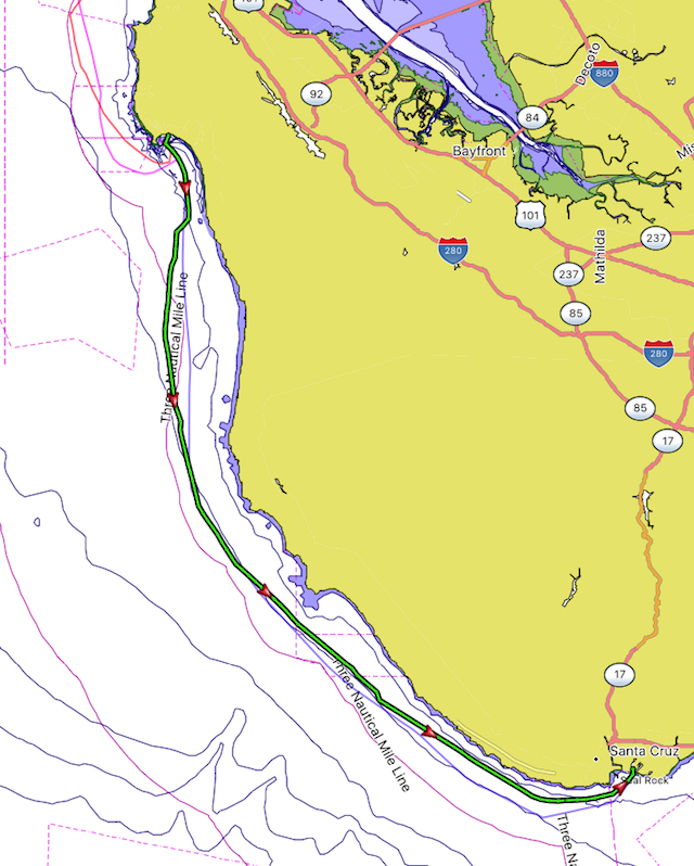
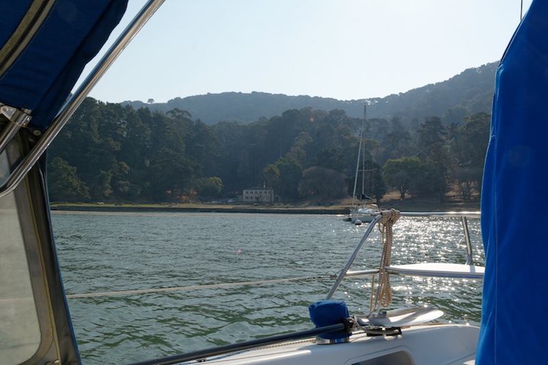
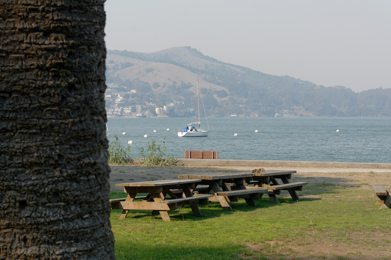
It was finally time this weekend to move my Catalina 270 from Alameda to my home port of Santa Cruz. We had a fun summer of sailing and weekend trips (Pier 39, Angel Island) in San Francisco Bay but I wanted to bring the boat home before winter weather (storms and bigger swell) arrives.

Joining me for the trip was Joe C. We’d raced together in the Club Nautique Bay Buoy Boogie event this summer. The trip to Santa Cruz can be done in one long a day but it is easier to break it down into two parts so I planned a stop at Half Moon Bay.

Day 1

NOAA Tidal Current Tables
San Francisco Bay Entrance (Golden Gate), Calif., 2017

#      Slack  Max Curr  Slack  Max Curr  Slack  Max Curr  Slack
----------------------------------------------------------------
29 Fr  0419  0700 1.6F  0954  1239 1.7E  1606  1752 0.8F  1936

National Weather Service Marine Forecast FZUS56 KMTR
Point Reyes To Pigeon Point To 10 nm-

FRI: NW winds 5 to 15 kt...
    increasing to 15 to 25 kt in the afternoon.
    Wind waves 3 to 5 ft. W swell 3 ft at 10 seconds.

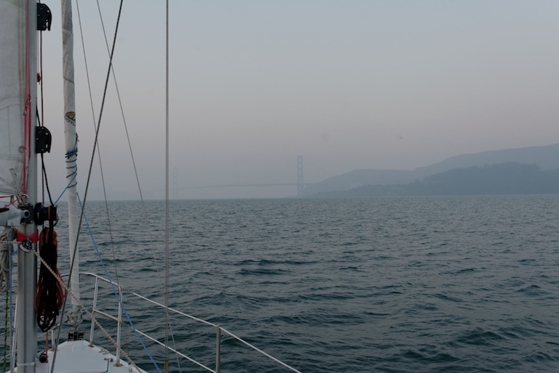
Forecast calls for nearly flat seas and a good breeze, so it seemed (and was) a perfect day for the trip south to Half Moon Bay.

We cast off from Marina Village at 7:46am.

Seven minutes later, the diesel sputtered and stalled! Might’ve been an early end to the trip but fortunately after waiting a few moments, the engine restarted easily and ran strong for the rest of the trip. The way it stalled felt like an air bubble in the diesel line but unlike my old Catalina 27, the fuel system on the 270 is self-bleeding. In any case, the engine ran perfectly for about 10 hours after that so no further problems.

DSC17A_3257
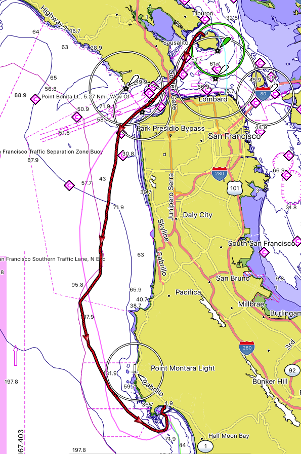
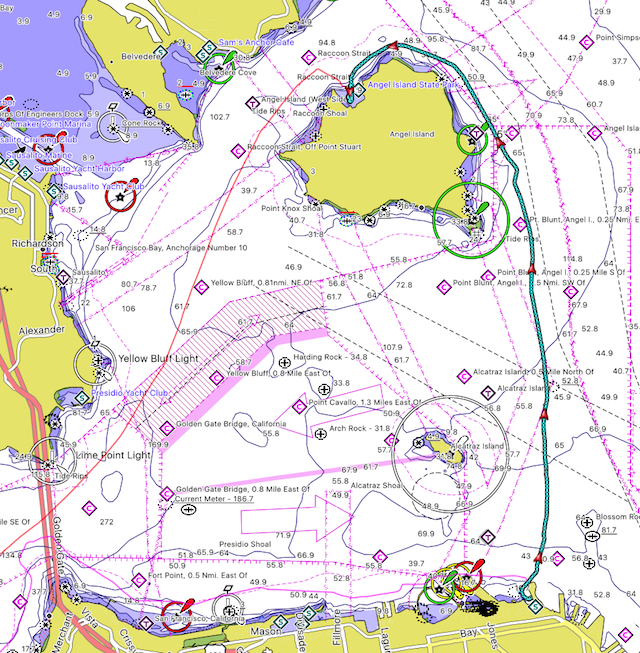
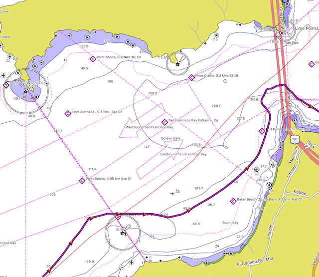
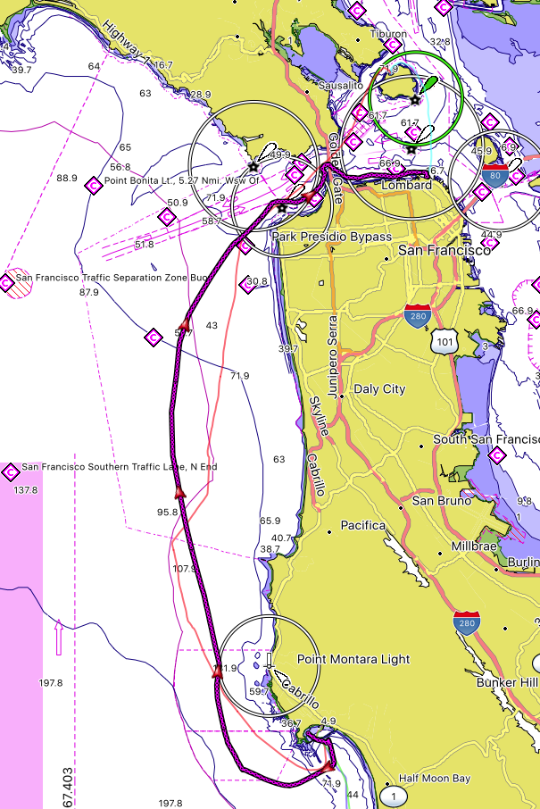
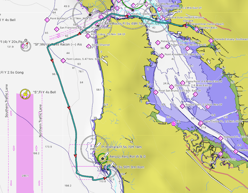
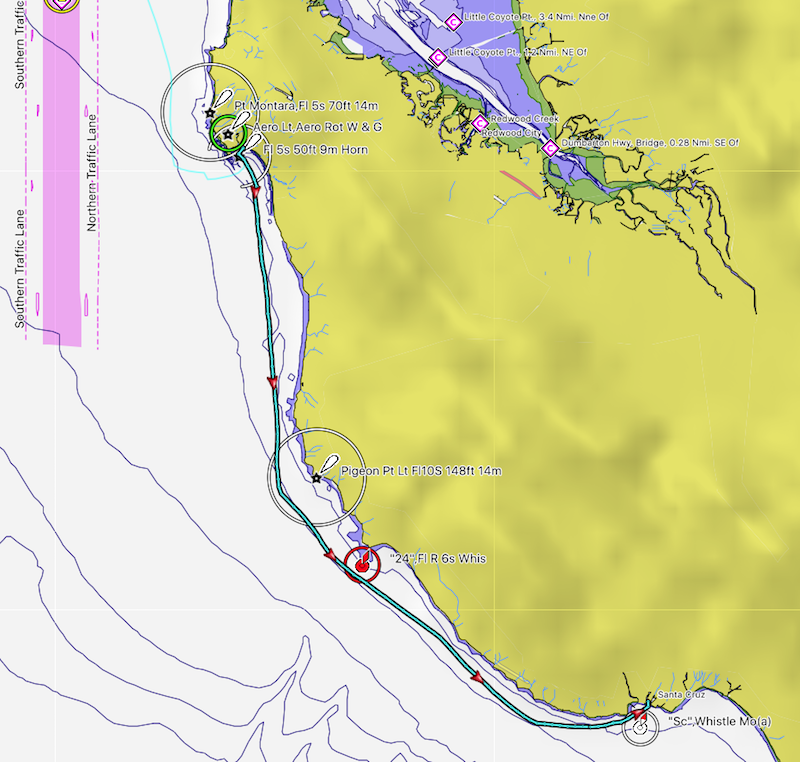
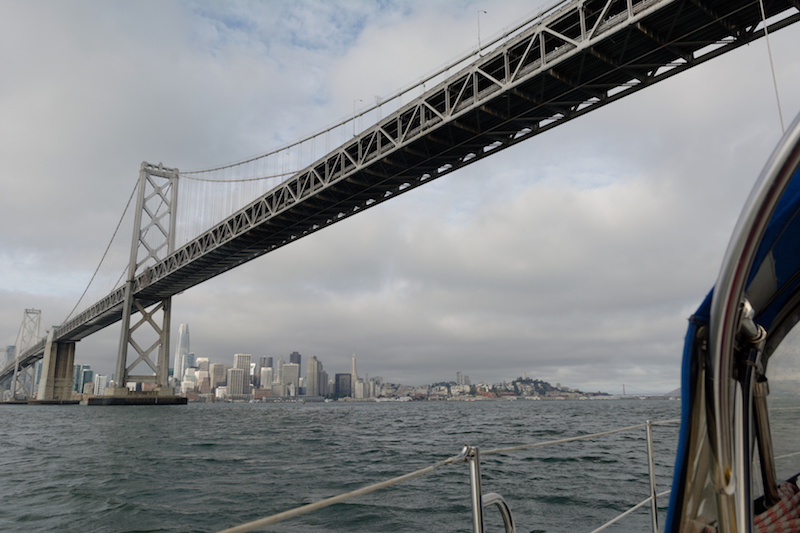
We motored out to the Golden Gate bridge, staying closer to the city front to avoid the trailing end of the flood. We crossed under the Golden Gate at 9:52am, right before slack water (9:54am). It would’ve been nice to time it to get a push from the ebb but this would’ve moved our arrival in Half Moon Bay a bit too late so slack was good enough for today.

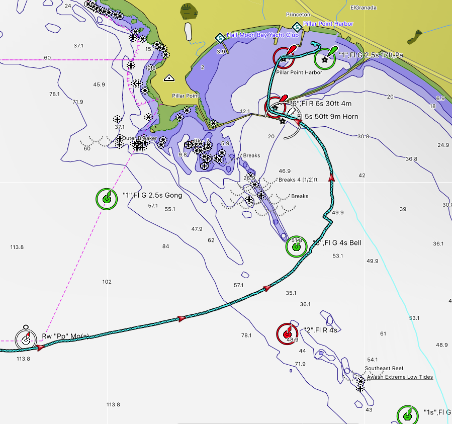
We kept motoring west just south of the shipping channel until the R”2″ buoy. This is a bit of a detour but it avoids the south bar. On a flat day like today we could’ve turned south much earlier but out of habit and prudence I prefer to turn left near R”2″.

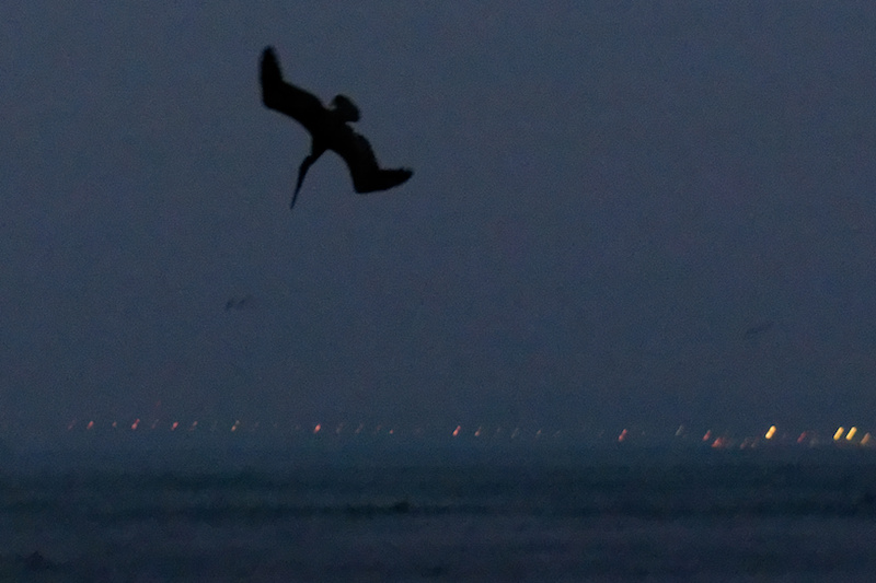
Several pods of dolphins popped in and out in the vicinity of the boat but none stayed for long.

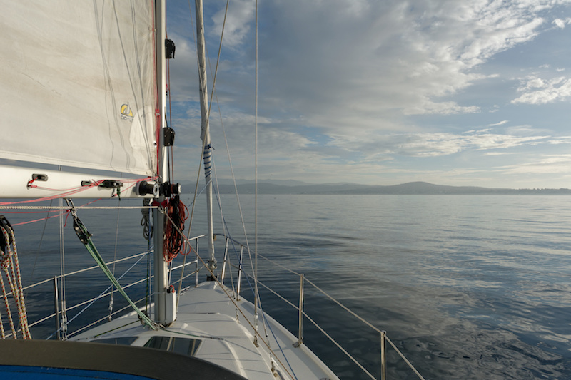
Once we reached R”2″ it was finally time to get the main up and go sailing! The reef line managed to shake itself into a knot around the main so that took some resolving but after that the engine was off and we’re sailing at about 11:30am.

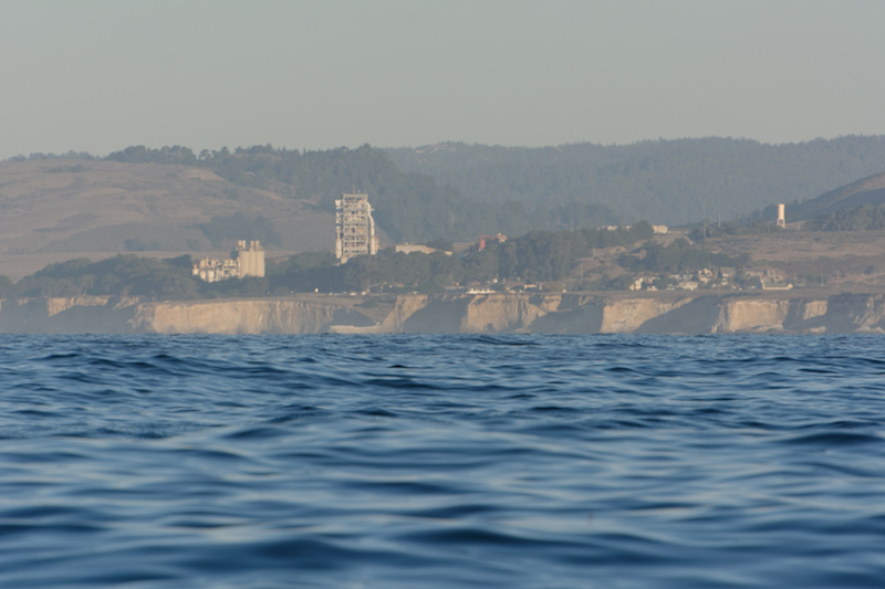
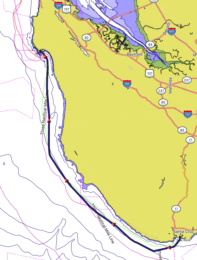
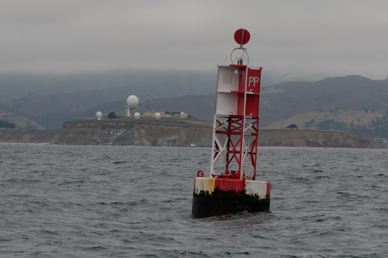
Sea was flat and breeze was good, both right on forecast. One long starboard tack past the R”26″ buoy (off Pt. Montara and the Colorado Reef) and down to the RW “PP” buoy marking the entrance to Pillar Point Harbor.

DSC17A_3270
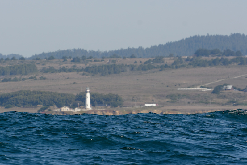
Pillar Point Harbor is perhaps best known (at least to non-boaters) as the location of the Mavericks surf break, a result of the reefs which surround this area. So it’s wise to stay in the correct channel.

hmb_entrance
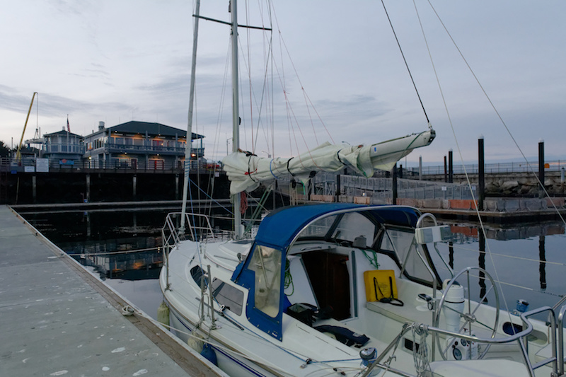
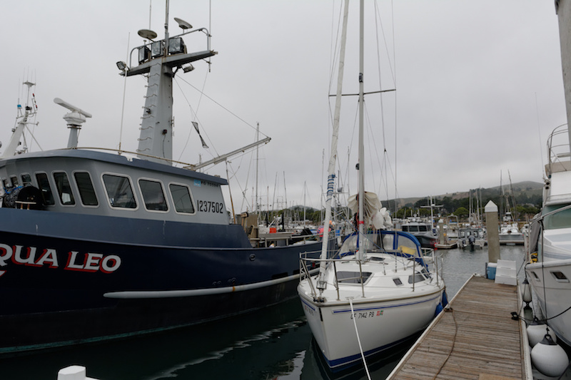
At 4pm we dropped the main after 4h:30m of sailing and by 4:25pm we were tied up at a guest slip in the harbor. Pillar Point is a busy commercial harbor so we had rather large neighbors:

DSC17A_3274For dinner and drinks we stopped by the Half Moon Bay Yacht Club, a fun spot, highly recommended.

Summary:

  • Departure: 7:46am
  • Arrival: 4:25pm
  • Distance: 42.8 nautical miles
  • Total time: 8h:39m
  • Motoring: about 4h

track_day_1

Day 2

National Weather Service Marine Forecast FZUS56 KMTR
Point Reyes To Pigeon Point To 10 nm-

FRI NIGHT: NW winds 15 to 25 kt. Wind waves 3 to 5 ft. NW swell 4 to 6 ft at 10 seconds.
SAT: NW winds 20 to 30 kt. Wind waves 4 to 6 ft. NW swell 6 to 8 ft at 10 seconds.

According to the forecast the wind was going to blow all night and increase to as much as 30 kts during the day. The trip to Santa Cruz is down wind and with the swells on the stern so I wasn’t worried about the wind but still, was hoping for closer to 20 than 30. As it turned out, this wind forecast was quite a bit off from reality.

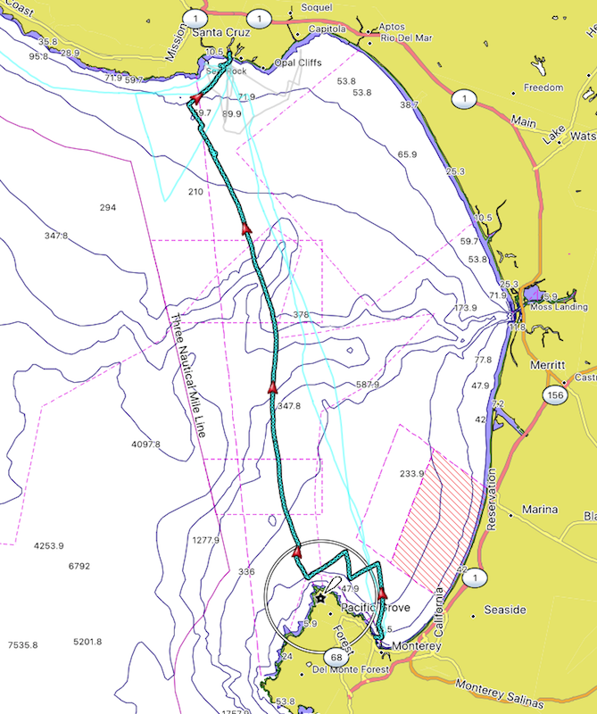
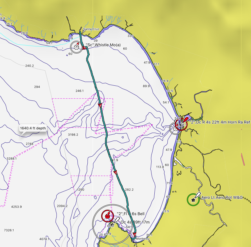
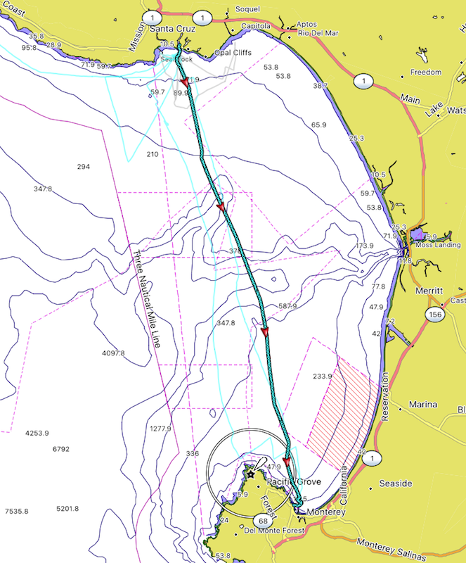
We cast off at 7:11am and motored south until past the G “1s” buoy and then hoisted the main at 7:55am. There was very little wind though (where is the 20-30kts?) so we kept motoring for a long time. The flapping of the main became annoying after not too long so I rigged a preventer and we kept it on for the rest of the trip. Much better!

The swells were perfect and only got better through the day. First on the starboard quarter and then right behind us as we turned near Pigeon Point, we spent all day surfing down the coast.

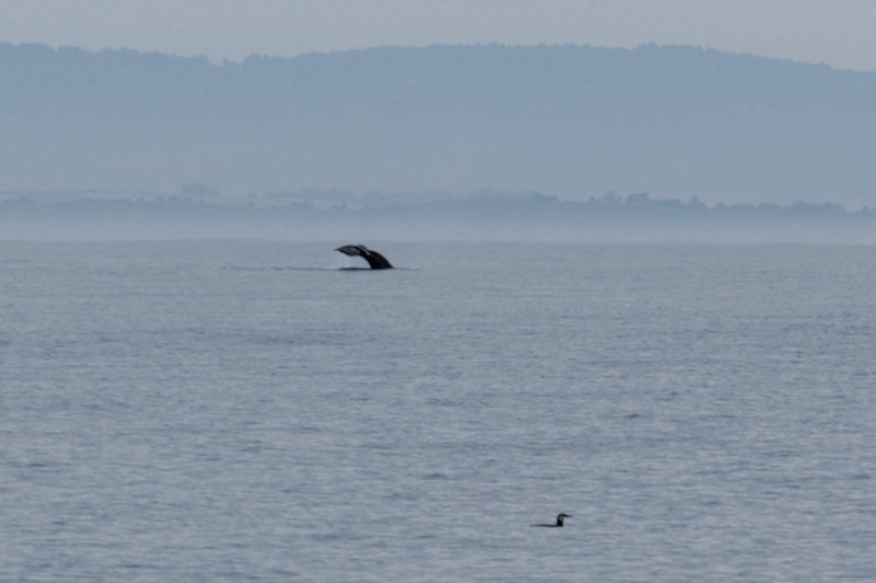
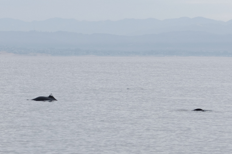
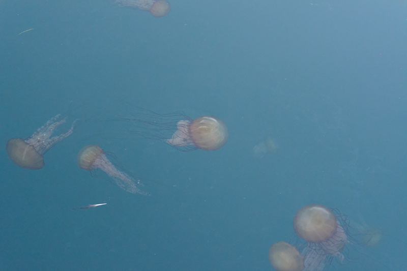
Between Half Moon Bay and Pescadero we saw a number of whales traveling in many groups. They all seemed to be congregated in this area as we didn’t see any further south (nor north).

I don’t have the exact time but I believe we were able to shut down the engine right around noon. The wind had picked up enough that by then we managed to keep the average speed above 5 knots without the engine. Under main alone as we were going just about dead downwind, no use for the jib today (I don’t have a whisker pole).

A bit further south we sailed by several Mola Molas (sunfish) sunning themselves near the surface. Always interesting to see these!

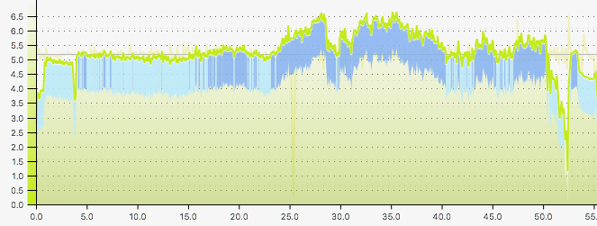
The ride down from Pigeon Point to Santa Cruz was ideal sailing, as good as it gets! Surfing down the 6-8ft swells running near hull speed for hours! Hull speed for a boat with a 24ft waterline length is about 6.5 knots and we were averaging 6.5-6.7 kts in this time window:

speed_day_2
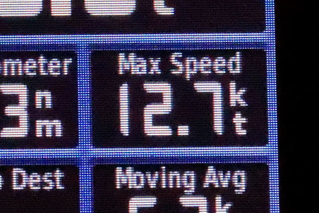
Surfing down the swells we’d regularly hit 8 and even 9 knots. The very largest one had us hitting an astonishing 12.7 knots (SOG)!

DSC17A_3319
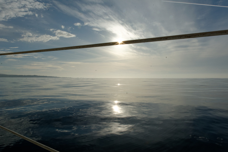
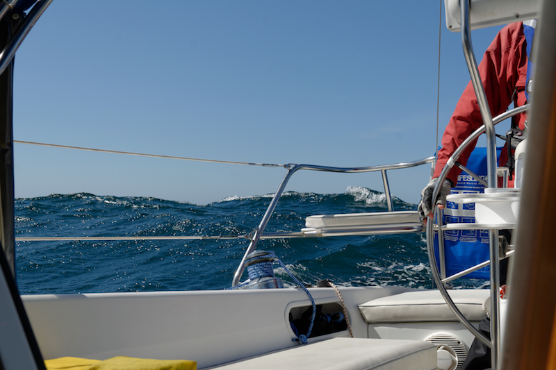
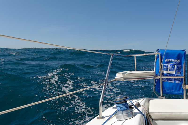
Here a couple photos of the swell at our stern about the lift the boat:

DSC17A_3289
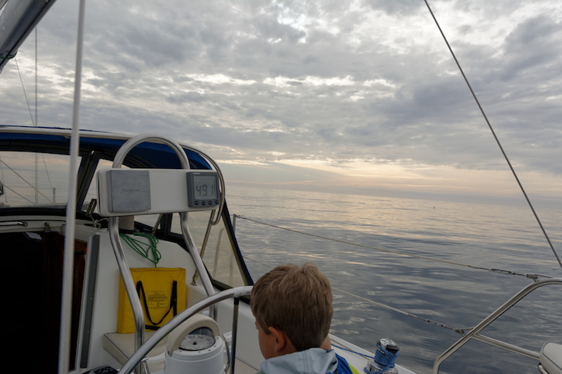
This is how much fun it was all afternoon:
DSC17A_3306I rarely take much video because I find that it never captures the essence of the ride, whether mountain biking nor sailing, so I’m always disappointed by the result. I took a bit of video on this day hoping to capture how fun this rollercoaster ride was but as always, it falls flat. Still, here is a link to it:

https://www.youtube.com/watch?v=AvJ41kaIcAk

Right around the Wilder Ranch area the swell shut down as if by a switch and shortly afterwards the wind was gone as well. This was around 3:20pm so then we motored the rest of the way into Santa Cruz. Tied up at the dock at 4:30pm.

Summary:

  • Departure: 7:11am
  • Arrival: 4:30pm
  • Distance: 48.3 nautical miles
  • Total time: 9h:19m
  • Motoring: about 6h

track_day_2


This was the first longer trip with substantial motoring I’ve done with this boat so I didn’t have a good sense of fuel consumption yet. So here’s what I observed:

  • At 2000rpm average speed is right around 5 knots.
  • At 2500rpm the average is a bit higher but not by much. Probably not worth it unless every fraction of a knot counts.
  • On this trip we motored just about 10 hours. Afterwards, I filled the tank with about 3 gallons so consumption was about 0.3 gal/hr.

Total distance 91 nautical miles from Marina Village Yacht Harbor to Santa Cruz Yacht Harbor.
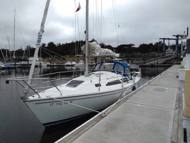
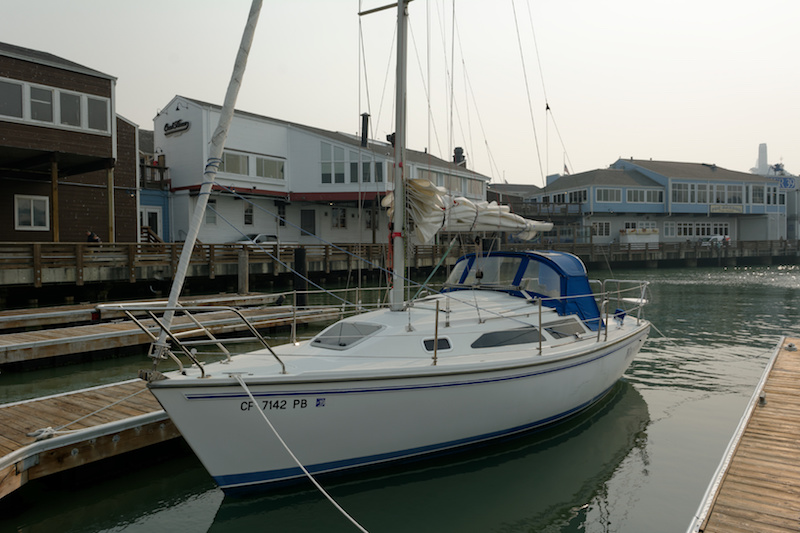
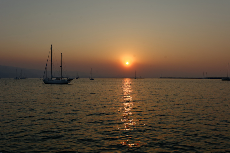
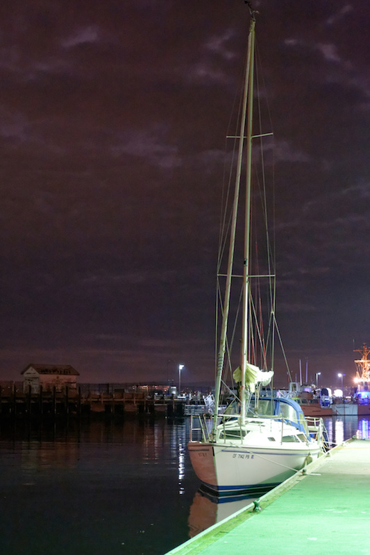